
Route 66 Arizona: The Best Stops, Landmarks & Roadside Attractions
Arizona has the longest intact stretch of drivable Route 66 remaining anywhere in the country, roughly 400 miles of original alignment running from the New Mexico border to the California line, with the interstate never more than a few miles away but the original road mostly still there, mostly still signed, and mostly still worth driving.
The state earns its reputation as the best section of the route. That reputation rests partly on scenery, the Colorado Plateau, the Painted Desert, the red rock country west of Flagstaff is one of the genuinely dramatic road trip landscapes in North America but mostly on the quality and density of what survives alongside the road. Arizona's Route 66 communities were bypassed by Interstate 40 beginning in the 1970s, and the bypass that damaged their economies also preserved their architecture. Towns that had no reason to demolish their 1950s motor courts and roadside attractions largely didn't, and the result is a corridor where the mid-century highway experience is more intact than anywhere else on the route.
What follows is a guide to nine essential stops on the Arizona stretch, one for each of the state's best-documented Route 66 landmarks, organized from east to west, the direction the highway was built to travel.
Best Route 66 Stops in Arizona: Quick List
The nine essential Route 66 Arizona stops, east to west:
Wigwam Motel (Holbrook): 19 concrete teepee units, operating since 1950
Petrified Forest National Park (near Holbrook): 225-million-year-old stone logs
Jackrabbit Trading Post (Joseph City), the HERE IT IS roadside advertising icon
Meteor Crater (near Winslow): best-preserved meteorite impact site on Earth
Standin' on the Corner Park (Winslow): Eagles song, bronze hitchhiker, trompe-l'œil mural
Twin Arrows Trading Post (Twin Arrows): 40-foot arrows, restored by Navajo Nation 2017
Seligman Main Street: origin point of the entire Route 66 preservation movement
Hackberry General Store, the route's most layered accumulation of roadside signage
Abandoned Gas Station Corridor (Hackberry to Kingman), the bypass preserved in desert air
Arizona has the longest drivable stretch of historic Route 66 in the country, approximately 400 miles from the New Mexico border to the California line.
Arizona's Route 66 at a Glance
Length of drivable alignment: approximately 400 miles Entry point from New Mexico: near Lupton, AZ, on the Navajo Nation Exit point into California: near Topock, AZ, via the historic Trails Arch Bridge over the Colorado River Key towns along the route: Holbrook, Winslow, Flagstaff, Williams, Seligman, Kingman, Oatman Driving time (alignment only, no stops): 7–8 hours Recommended time with stops: 2–3 days minimum
The Arizona portion of Route 66 runs through three distinct environments: the high-plateau desert east of Flagstaff (elevation 5,000–7,000 feet, cool nights even in summer), the ponderosa pine country around Flagstaff and Williams (over 7,000 feet, occasional snow through April), and the Mojave Desert transition west of Kingman (lower elevation, extreme summer heat). Pack accordingly for all three.
The Nine Essential Route 66 Arizona Stops
1. Wigwam Motel, Holbrook
The nineteen concrete teepees at the Wigwam Motel in Holbrook announce themselves from the road in a way that makes slowing down feel like the only reasonable response. The signs say wigwams. The shapes say teepees. The distinction was never the point.
Chester Lewis built the Holbrook Wigwam in 1950 as a franchise unit of a small chain developed by Frank Redford in the 1930s, a concept built on a simple premise: a sufficiently unusual building will stop traffic that a conventional motor court cannot. The original Wigwam Village opened in Cave City, Kentucky in 1937 and eventually generated seven locations. Three survive. The Holbrook unit is the westernmost and the one most travelers encounter first.
The units have been updated without altering the exterior geometry that defines the property: air conditioning, modern plumbing and original 1950s vehicles are parked in the central courtyard on rotating display. The interior of each cone is more spacious than it appears from outside, and the acoustics at night produce a particular stillness that a standard motel room cannot replicate.
Book well in advance. The Wigwam fills consistently through summer.
Practical: 811 W. Hopi Drive, Holbrook. Open year-round. Reservations strongly recommended May–September.
2. Petrified Forest National Park, Near Holbrook
Two hundred and twenty million years ago, this corner of Arizona was a tropical forest at the edge of a vast inland sea. Trees fell into waterways, were buried under sediment faster than they could decay, and had their organic material replaced molecule by molecule with silica. The result is scattered across the Painted Desert today: stone logs in amethyst, jasper, carnelian, and obsidian black, some longer than a school bus, lying where the geology deposited them.
Route 66 once ran along the northern boundary of what was then a national monument, and proximity to the highway created an immediate problem: visitors took the wood. The park service estimated losses of fourteen tons of petrified wood annually before protective measures and strict enforcement brought that figure down. The depletion is still visible in sections closest to the historic alignment.
The Painted Desert portion of the park is its own spectacle. Layered badlands in pink, red, lavender, and grey that shift through the day as the light changes. Morning and late afternoon produce the most saturated readings. Midday compresses all of it into something accurate but incomplete.
Practical: The park entrance is off I-40 at Exit 311 (north entrance) or US-180 south of Holbrook (south entrance). Allow 2–3 hours minimum. The 28-mile park road connects both entrances and should not be rushed.
3. Jackrabbit Trading Post, Joseph City
The sign comes first, a black jackrabbit silhouette on a yellow background, bolted to a post on the highway shoulder, reading HERE IT IS in capital letters that are simultaneously the most confident and least informative advertising copy on the Arizona corridor. By the time it appears, most drivers are already half-committed to stopping.
James Taylor opened the Jackrabbit Trading Post in 1949 on a stretch of Route 66 between Holbrook and Winslow that offered limited alternatives and a great deal of open country. The sequential roadside sign campaign (jackrabbit silhouettes placed at intervals along the approaching highway), each one building anticipation for the next, making it among the more effective pre-digital advertising systems on the route, borrowing the structure of the Burma-Shave verse campaigns and reducing it to a single declaration that became more amusing with each repetition.
The trading post continues to operate, the yellow signs are maintained along the corridor, and the format has not changed: approach, read the signs, feel the mild narrative pull of a roadside advertisement that has been running for seventy-five years, stop. The system still works.
Practical: 3386 AZ-Route 66, Joseph City. Watch for the signs beginning several miles east on the old alignment.
4. Meteor Crater, Near Winslow
Fifty thousand years ago, a nickel-iron meteorite roughly 150 feet across struck the Colorado Plateau at 28,000 miles per hour, releasing energy equivalent to ten megatons of TNT and excavating a hole 4,000 feet wide and 550 feet deep. It is the best-preserved meteorite impact site on Earth, and it sits six miles south of Route 66 near Winslow, close enough to visit between breakfast and lunch, significant enough to justify rearranging the day.
Daniel Barringer spent nearly three decades beginning in 1903 demonstrating that the crater was formed by an impact rather than a volcanic event, a conclusion that now seems obvious but was vigorously disputed in his lifetime. He also believed a massive iron meteorite remained buried beneath the crater floor and invested substantially in drilling operations to find it. The meteorite had largely vaporized on impact, which resolved the geology but ended the mining project. NASA used the crater as a training site for Apollo astronauts in the 1960s, reasoning that the impact geology offered the closest available approximation of the lunar surface.
The scale of the crater does not fully register until you are standing on the rim with the scale markers on the floor below providing something to measure against. The cognitive recalibration that follows, when the actual size replaces the estimated size, and that specific experience the overlook is there to produce.
Practical: Exit I-40 at Exit 233, then six miles south. Privately owned and operated; admission fee applies.
5. Standin' on the Corner Park, Winslow
In 1972, Glenn Frey and Jackson Browne wrote a song with the line well, I'm standing on a corner in Winslow, Arizona, a line so specifically located that Winslow eventually had no practical choice but to build a park around it. The result is a small plaza on the corner of Second Street and Kinsley Avenue that receives more visitors annually than the surrounding geography would otherwise predict.
"Take It Easy" was released by the Eagles in 1972 as the lead single from their debut album and became one of the defining recordings of California country-rock. The Winslow line was Jackson Browne's, drawn from a drive through Arizona that lodged one corner of one town in a song that went on to sell in numbers Winslow could not have imagined. A bronze hitchhiker stands on the corner. A flatbed Ford is painted as a trompe-l'œil mural on the adjacent brick wall. A second statue of Glenn Frey was added after his death in 2016.
Stand on the corner. The park exists specifically for this purpose, and the mural is painted with enough precision to read convincingly from the sidewalk. The whole arrangement rewards the thirty seconds of sincerity required to engage with it.
Practical: Corner of Second Street and Kinsley Avenue, Winslow. Free. Open at all hours.
6. Twin Arrows Trading Post, Twin Arrows
Two giant arrows stand nose-down in the Arizona desert between Winslow and Flagstaff, planted at an angle suggesting either enormous velocity or an extremely deliberate artistic decision. The arrows are forty feet tall, painted yellow, and they mark the ruins of a trading post that served Route 66 traffic for decades before the interstate made it commercially unviable.
The arrows were the trading post's advertising structure, a roadside spectacle designed to register at highway speed and produce the specific response that stops traffic. They succeeded well enough that the surrounding community eventually took its name from them, which is the kind of nominative reversal that happens when advertising outlasts its commercial justification. The Navajo Nation undertook a restoration of the arrows around 2017, repainting them in their original yellow and stabilizing the structures, ensuring they remain visible from I-40 long after the trading post's walls have finished their slow return to grade.
The buildings are deteriorating; keep your distance from the structure itself. The arrows are best appreciated from a hundred yards out, where the scale registers against the surrounding desert.
Practical: Take Exit 219 off I-40, follow the frontage road east. Free and accessible.
7. Seligman Main Street, Seligman
Angel Delgadillo has been cutting hair in Seligman since 1950. He was there when Interstate 40 bypassed the town in 1978 and the commercial economy collapsed within months. And he was the one who called the meeting in 1987, organized the surviving business owners, and proposed lobbying the state for a historic highway designation that most people in the room thought was impractical.
The Arizona Historic Route 66 Association formed from that meeting. The state designation followed. The revival of interest that spread from Seligman across all eight states, the preservation programs, the tourism infrastructure, the renewed cultural attention to the highway, which traces directly to a barbershop meeting in a town of a few hundred people in the Arizona high desert.
Seligman's main street today is layered in a way few Route 66 towns have managed: murals, vintage signage, rebuilt storefronts, actual diners serving actual locals alongside actual tourists. It functions simultaneously as a heritage attraction and a functioning town, which is the rarest and most sustainable outcome in roadside preservation. Delgadillo is approaching his centennial. Stop at the barbershop on the north side of the main drag.
Practical: Historic Route 66, Seligman. The main street is compact and walkable. The barbershop doubles as a gift shop and informal Route 66 museum.
8. Hackberry General Store, Hackberry
The Hackberry General Store is covered in signs: vintage tin advertisements, Route 66 shields, license plates from two dozen states, painted slogans, automobile memorabilia layered over the building's exterior until the original structure has become essentially theoretical. A 1957 Corvette sits out front. The whole arrangement exists because Bob Waldmire, the son of the man who invented the corn dog at Springfield's Cozy Dog Drive-In, bought a derelict service station here in 1992 and established it as a gallery, trading post, and personal statement about what the highway could still be.
Waldmire understood Route 66 as a continuous art environment. He produced densely detailed panoramic drawings of the highway's towns and landscapes from a converted bus he lived in on the road, and he understood that travelers arriving from a hundred miles of open desert were primed to receive visual information with unusual intensity. Subsequent owners have maintained and amplified the character he established.
Spend time with the exterior before going in. The accumulation of signage rewards close reading. Specific pieces emerge from the overall density as individually interesting objects: the lettering on a pre-war Coca-Cola tin, a license plate from a state that no longer uses that design, a hand-painted sign for a business that closed before anyone reading it was born.
Practical: 11255 E. Route 66, Hackberry. Open daily; hours vary by season.
9. Abandoned Gas Station, Hackberry / Kingman Area
The pump islands are still standing, which is frequently the last thing to go. The canopy has come down. The glass is gone from the office window. The concrete apron has begun the slow return to grade.
The stretch of Route 66 between Hackberry and Kingman produced a concentration of abandoned service infrastructure that photographers have documented more thoroughly than almost any comparable corridor. This section was bypassed by Interstate 40 in the 1970s, leaving the original two-lane alignment as a quiet road through country that could no longer sustain the commercial density the highway had once supported. The gas stations and diners that had operated for forty years closed in sequence, and the desert began the patient work of reclamation it is still conducting.
What the desert does to an abandoned building differs from what humidity or cold does, the process is slower and cleaner. A gas station abandoned in rural Arizona in 1978 still reads unmistakably as a gas station. The pump islands are still standing.
Practical: The frontage road between Hackberry and Kingman. For the broader story of Route 66's bypassed infrastructure, see the Route 66 Ghost Towns guide. No specific address. This is a stretch to drive slowly rather than a single destination. Several abandoned structures are visible from the road.
How to Drive Route 66 in Arizona
Start point: The Arizona-New Mexico border near Lupton, where I-40 crosses onto the Navajo Nation. The original alignment picks up immediately on the south side of the interstate.
Direction: West is correct. The nine stops above are organized east to west, which is the traditional direction of travel and the one the highway was built to carry.
Time required: The nine stops above, done properly, require two full days. Three is better. Add a night at the Wigwam Motel in Holbrook and a night in Seligman (the Canyon Lodge or the Historic Route 66 Motel) to anchor the drive with period-appropriate accommodation.
What to drive: Any vehicle works for the main alignment. A few sections of unpaved or poorly maintained road exist west of Seligman and on the Oatman route, these are short and passable in most cars but worth confirming current road condition before committing.
What to skip: The stretch through Flagstaff on Route 66 (which runs through active commercial development and offers little of the historic alignment experience) can be bypassed via I-40 without missing anything significant between Winslow and Williams. Oatman, a former gold mining town near the California border with wild burros walking the main street, is a legitimate stop if time allows, not covered in depth here but worth an hour.
The Complete Arizona Route 66 Guide
These nine Route 66 Arizona stops are drawn from Route 66 Road Trip: 50 Landmarks, Legends & Roadside Stories from America's Main Street, which covers the full Arizona alignment, including the detailed story behind the Wigwam Motel franchise, what Angel Delgadillo's 1987 organizing meeting actually accomplished, and why the abandoned gas station corridor between Hackberry and Kingman is worth driving slowly rather than skipping. The book covers all fifty landmarks across all eight states at the same depth. For more on the 2026 centennial, see What's Happening on Route 66 in 2026.
Frequently Asked Questions
What are the best stops on Route 66 in Arizona? The nine best-documented stops on the Arizona alignment are the Wigwam Motel (Holbrook), Petrified Forest National Park, the Jackrabbit Trading Post (Joseph City), Meteor Crater (near Winslow), Standin' on the Corner Park (Winslow), Twin Arrows Trading Post, Seligman Main Street, Hackberry General Store, and the abandoned gas station corridor between Hackberry and Kingman.
How long is Route 66 in Arizona? The Arizona stretch of Route 66 runs approximately 400 miles from the New Mexico border near Lupton to the California border near Topock, making it the longest state segment of the historic alignment in the country.
Is the Wigwam Motel in Holbrook still open? Yes. The Wigwam Motel in Holbrook has been in continuous operation since 1950 and remains one of the most popular overnight stops on the Arizona corridor. Rooms book out quickly in summer; advance reservations are strongly recommended for travel between May and September.
Can you still drive Route 66 through Arizona? Yes. The majority of the historic Route 66 alignment through Arizona is drivable on maintained roads, mostly running parallel to I-40 as a two-lane frontage road. A dedicated Route 66 highway map is recommended, as some sections require leaving the interstate and navigating unsigned segments of old alignment.
What happened to the Twin Arrows Trading Post? The Twin Arrows Trading Post closed in the 1990s after Interstate 40 redirected the through-traffic that had sustained it. The building has since deteriorated, but the two giant yellow arrows were restored by the Navajo Nation around 2017 and remain standing and visible from I-40 at Exit 219.
Where is the Route 66 sign in Arizona? Arizona has numerous Route 66 signs along its historic alignment. The most photographed are typically the highway shields on the roadway itself in Seligman and along the frontage road east of Flagstaff. The Arizona Department of Transportation maintains signed sections of the alignment throughout the state.
Is Route 66 in Arizona the same as I-40? No. Interstate 40 runs parallel to and replaced Route 66 in Arizona, but the two roads are distinct. The original Route 66 alignment survives as a frontage road or independent road on most sections and can be driven separately from the interstate. Some communities (Seligman and Hackberry in particular) are only accessible by exiting the interstate and following the old alignment.
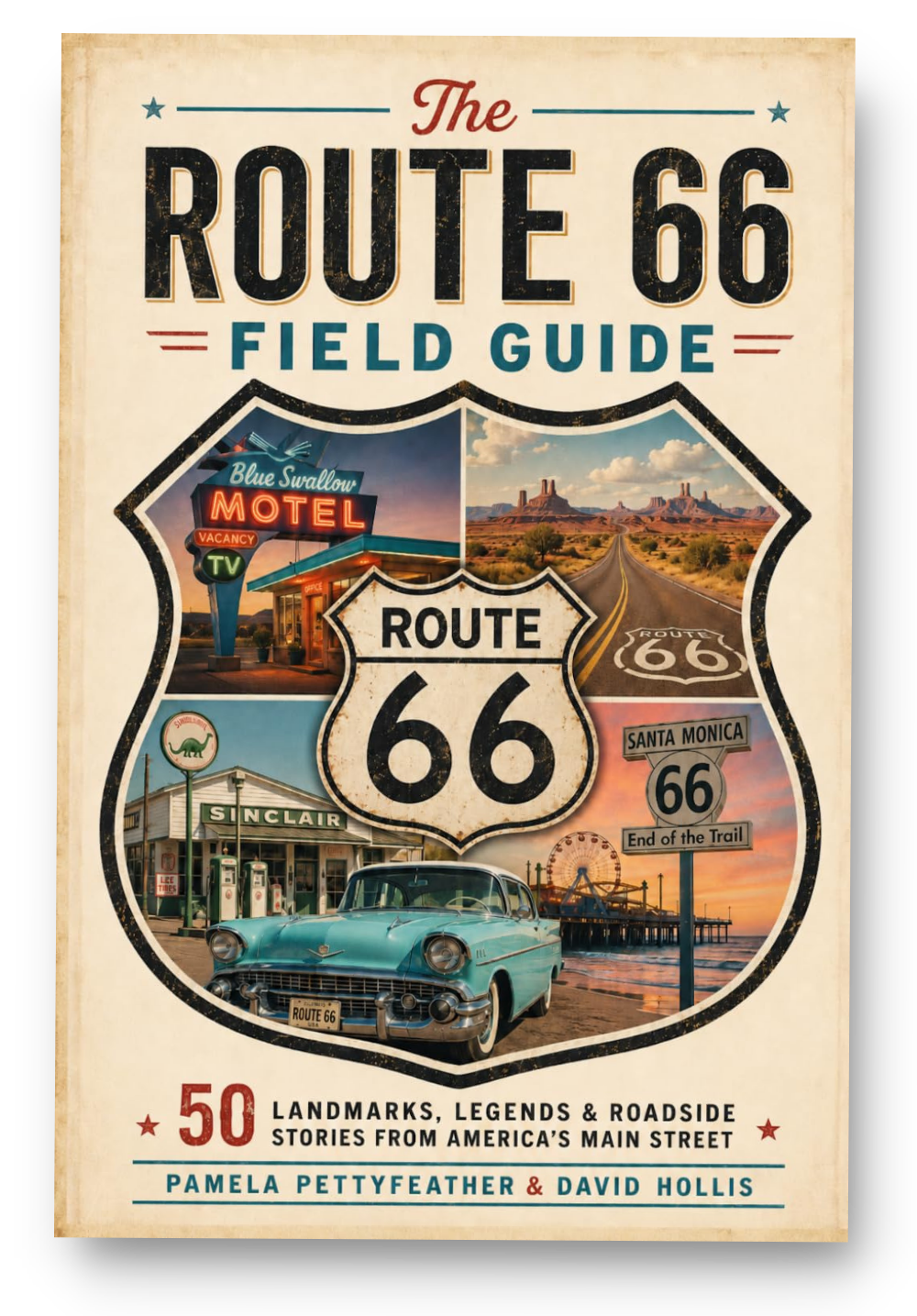
This article draws from The Route 66 Field Guide: 50 Landmarks, Legends & Roadside Stories from America's Main Street, a 50-landmark guide to Route 66 across all eight states.