
Ghost Towns of Route 66: What the Highway Left Behind
The same force that built Route 66 towns destroyed them. For thirty years, a steady current of westbound travelers sustained gas stations, motor courts, diners, and repair shops at intervals precise enough to anticipate how far a car could go before it needed fuel, food, or a bed. Then Interstate 40 and Interstate 55 arrived, parallel roads running straighter and faster a few miles away, and the current redirected. The travelers followed. The businesses did not.
What remains is one of the more specific categories of American ruin: not war, not flood, not industrial collapse, but the withdrawal of a road. These route 66 ghost towns are structurally intact in ways that more dramatic ruins are not: rooflines still in place, commercial signage still legible, the spatial logic of a working town still readable in the arrangement of buildings along a main street that no longer carries traffic. The desert and plains climates that produced most of these towns are also the ones least likely to accelerate their disappearance, which means that a gas station abandoned in rural New Mexico in 1979 often reads more clearly today than a comparable building in a wetter state would after a decade.
This is a guide to the best-documented ghost towns on the Route 66 corridor: what produced them, what survives, and what to expect when you get there.
Ghost Towns on Route 66: Quick Reference
The most documented Route 66 ghost towns and abandoned sites, by state:
Cuervo, NM: ruined adobe church, water tower, high-plains isolation; east of Santa Rosa
Glenrio, TX/NM border: state-line ghost town, National Register of Historic Places
Two Guns, AZ: zoo ruins, disputed Apache cave, the most complicated history on the route
Amboy, CA, nearly abandoned; Roy's Motel still operating; active volcano visible from parking lot
Red Oak II, MO, a ghost town physically rebuilt from its ruins by folk artist Lowell Davis
Ghost towns on Route 66 were almost universally created by a single cause: construction of Interstate 40 and Interstate 55, which bypassed the original alignment and redirected through-traffic to interchange exits miles from existing town centers. Most towns lost their commercial traffic within months of the bypass opening.
How the Interstate Made Ghost Towns
Understanding what happened to Route 66 towns requires understanding what Route 66 was. The highway was not simply a road; it was a commercial ecosystem. Every sixty to ninety miles, roughly the fuel range of a 1950s car, there was a town positioned to provide what travelers needed. The towns had not, in most cases, been built for travelers. Many existed because of railroads, or ranching, or farming. Route 66 arrived and added a second commercial identity: service provider to the westbound stream.
When Interstate 40 was constructed parallel to Route 66 through New Mexico, Texas, and Arizona during the 1960s and 1970s, it did not merely offer a faster route. It restructured the entire geography of travel. Interstate interchanges created commercial nodes at locations determined by engineering logic rather than existing settlement patterns. The travelers went to the interchange exits, where new chain motels and franchise restaurants were built specifically to serve them. The towns along the original alignment, which were rarely at an interchange, lost the traffic almost overnight.
The effect was not gradual. Business owners in Seligman, Arizona, and Cuervo, New Mexico, and Glenrio on the Texas-New Mexico border describe the same experience: traffic on Monday, none on Tuesday, the slow arithmetic of the months that followed. Towns that had supported multiple gas stations, a motel, a diner, and a post office contracted to one business, then none. Some residents followed the commerce south or east to the interstate exchanges. Others stayed.
The Ghost Towns Worth Stopping For
Cuervo, New Mexico
Cuervo sits on a rolling plateau east of Santa Rosa, on the long crossing of the New Mexico high plains between the Texas border and Albuquerque. A ruined Catholic church occupies what was the center of town, its adobe walls still standing at full height in most sections, the bell tower intact, the plaster retaining enough of its original finish to read as a building rather than a pile. The roof has partially collapsed. The window openings receive the light the way that photographers who specialize in abandonment find immediately useful.
The community formed in the early twentieth century around the Rock Island Railroad line and the early highway traffic that would become Route 66. At its modest peak, Cuervo had a post office, a school, gas stations, and the population of a small high-plains service town, enough to sustain itself as long as the trains stopped and the highway ran through the middle. The railroad reduced service. Route 66 traffic redistributed when the alignment shifted. The population followed the commerce west. The post office closed in 1969.
What distinguishes Cuervo from the many Route 66 ghost towns is the quality of what remains. The church is a building of genuine architectural dignity that has no interpretive apparatus, no managed access, and no admission fee. The water tower still carries the town's name in faded lettering. Some commercial structures retain the outlines of hand-painted signs. The New Mexico high plains provide an exposure that wetter-climate ruins do not have, the sky is large, the light is direct, and everything reads clearly against the surrounding scrub.
Getting there: Exit I-40 at the Cuervo exit (Exit 291) and follow the frontage road north. The church and water tower are visible from the road. Approach on foot from a distance rather than driving into the remaining structures.
Glenrio, Texas / New Mexico
Glenrio has the distinction of being a ghost town that straddles a state line, the main street runs along the Texas-New Mexico border, with buildings on both sides of the jurisdictional divide and a filling station sign that once advertised whichever state's gas taxes made fuel cheaper that year. It is one of the most completely abandoned communities on the route, and the arrangement of its ruins along the old alignment makes the commercial logic of a Route 66 service town legible in a way that more fragmentary ghost towns cannot match.
The town's population peaked somewhere around thirty to forty people, small even by the standards of the high plains. The aligned commercial strip, the motel ruins, the collapsed diner, and the rusting fuel infrastructure together tell a compressed version of the Route 66 commercial arc: built for travelers, sustained by travelers, ended when the travelers rerouted. Glenrio was bypassed by I-40 in 1975. It was never incorporated, never had a zip code of its own, and was never large enough to have institutional infrastructure worth preserving. What survives is simply what no one had reason to demolish.
The Texas side of Glenrio is on the National Register of Historic Places. The designation has not generated restoration funding but has prevented the most straightforward forms of demolition. The ruins are accessible from the old Route 66 alignment and visible from I-40, where passing drivers occasionally notice the profile of abandoned buildings against the flat horizon and wonder what they were.
Getting there: Exit I-40 at Exit 0 (westbound) or Exit 2 (eastbound) near the state line. The original alignment runs through town and is accessible by car.
Two Guns, Arizona
Two Guns is the Route 66 ghost town most likely to appear in photography collections, and for reasons that go well beyond aesthetics. The ruins at Two Guns include not just abandoned commercial structures but the remains of a 1920s zoo, a murder site, a fraudulent Apache death cave tourist attraction, and a gas station that burned down twice under circumstances that were disputed at the time and remain disputed. The full history of Two Guns is a concentrated version of the Route 66 attraction economy at its most unscrupulous.
Harry Miller, who renamed himself Two Gun Miller, established the site in the early 1920s on a stretch of what would become Route 66 near Canyon Diablo. He promoted a nearby canyon as the site of an Apache ambush, charged admission to see "Apache Death Cave," and stocked a roadside zoo with mountain lions. The actual history of the site is considerably more complicated and considerably less Apache than Miller's marketing suggested. The zoo animals died. Miller was eventually killed on the property in 1926 under circumstances that were not fully clarified at the time and have not been since.
What remains today (accessible from the I-40 frontage road near Exit 230) is a collection of stone ruins, the crumbling zoo enclosures, canyon access, and the specific atmospheric quality of a place where the history is genuinely strange and the documentation is genuinely thin. Visit in the morning or late afternoon when the Arizona light describes the stonework at full effect.
Getting there: Exit I-40 at Exit 230 east of Flagstaff, then follow the frontage road. The ruins are on private property; view from the road or access respectfully.
The Abandoned Motel: Texas Panhandle
The swimming pool is full of blown sand. The office window is broken in its frame. The sign still holds the letters for a brand the chain stopped using sometime in the 1980s. There are several dozen abandoned motels along the Texas panhandle stretch of Route 66, and they constitute a category of ruin distinct from the ghost towns, not communities that lost their population, but individual businesses arrested at the precise moment the interstate took the traffic somewhere else.
The panhandle's flat light and open sky give particular clarity to what abandonment looks like here. A motel that in a wetter climate would disappear into vegetation stands fully exposed in West Texas, every broken window visible from the road, every collapsed carport readable across fifty yards. These structures followed the same operational arc: opened between 1945 and 1965 to serve the surge of postwar highway travel, sustained through the 1960s by through-traffic, then bypassed abruptly when Interstate 40 redistributed the travelers to interchange exits where the land was cheaper and the parking was easier.
The most instructive element of an abandoned Route 66 motel is not the picturesque deterioration but the specific details that survive it: concrete unit numbers still bolted beside the doors, the rusted bracket where the ice machine stood, the ghost of a sign outline on a blank wall. These are the details that identify what the building was, in a way the collapsed roofline alone cannot.
Where to find them: The frontage roads parallel to I-40 between Shamrock and Amarillo, Texas, pass several abandoned motor court properties. Drive slowly on the old alignment; many are visible from the road.
Amboy, California: A Town Sold Whole
Amboy is not a ghost town in the conventional sense. Roy's Motel & Café still operates as a fuel stop, and the iconic Googie pylon sign still rises above the Mojave flats with ROY'S in mid-century neon. But Amboy is a ghost town in the economic sense: in 2005, the entire town (buildings, land, post office designation, water rights) was sold as a single property for $425,000. The buyer acquired a mid-century commercial landscape and a handful of structures in a location that has no practical reason to support permanent habitation now that the highway no longer carries the traffic that sustained it.
The motel units are preserved but not bookable. The café operates on limited hours. The population of Amboy is typically counted in single digits. What makes the stop worthwhile is the landscape it occupies. Roy's sits in the middle of the Mojave with Amboy Crater, a cinder cone volcano that last erupted approximately 500 years ago, visible from the parking lot. The combination of mid-century roadside commercial archaeology and active volcanic geology in a landscape of complete flatness is not reproducible anywhere else on the route.
Getting there: Amboy is on the National Trails Highway (old Route 66) between Ludlow and Twentynine Palms, California. Fill your tank at Roy's regardless of the gauge reading, the next fuel stop is a meaningful distance in either direction.
Red Oak II, Missouri: A Ghost Town Rebuilt
Lowell Davis grew up in a small Missouri town called Red Oak, watched it empty and fall to ruin over the course of his lifetime, and then did something that no ghost town has otherwise managed: he bought a field outside Carthage, dismantled the buildings of the original Red Oak, and rebuilt the town piece by piece on new ground. The general store, the filling station, the blacksmith shop, the feed store, and several residences, each taken apart, transported, and reconstructed with their original materials intact.
Red Oak II is not a replica. It is the actual structures, reassembled, populated with Davis's sculpture and period objects, and set on a Missouri hillside where nothing like it has any logical reason to be. It sits near the Route 66 corridor in Missouri and represents the opposite end of the ghost town spectrum from Cuervo or Glenrio, not a community dissolving into the landscape, but one man's effort to pull a community back from dissolution by purely physical means.
Davis died in 2020. The property has been maintained by family. It is visible from the road and partially accessible. Approach respectfully. This is someone's life work set in a field, not a managed attraction, and it reads completely differently up close than from a passing car.
Getting there: Off Missouri Route 96 south of Carthage. Visible from the road.
What to Know Before You Visit a Route 66 Ghost Town
Access: Most Route 66 ghost towns are accessible from the old highway alignment or I-40 frontage roads. Many are on or adjacent to private property. Photograph from the road or access with care; entering deteriorating structures carries genuine structural risk.
Conditions: Desert and plains ghost towns are exposed. There is no shade, often no facilities, and, particularly in summer, no forgiveness for a car that runs low on fuel. Top up your tank before leaving the last interstate exchange. Carry water.
Time of day: Early morning and late afternoon provide the best light for desert ruins. Midday flattens the structures and produces the least useful photographs. Many abandoned buildings are also significantly hotter inside than out during summer afternoons.
What to look for: The details that identify what a building was (unit numbers, brand signage, pump island layouts, window arrangements) tell a more specific story than the general state of deterioration. Resist the impulse to photograph only the picturesque angles. The mundane details are the record.
What not to take: Several Route 66 ghost towns are on the National Register of Historic Places. Removing materials from any of them is illegal under federal preservation law. The more general ethical argument, that every object removed diminishes what remains for the next visitor, and applies whether the site is registered or not.
The Ghost Town Route: Planning Your Drive
Several of the best ghost towns of Route 66 sit close enough together to form a coherent sub-itinerary. The New Mexico stretch between Tucumcari and Santa Rosa passes directly through Cuervo and Tucumcari itself is covered in the Route 66 Neon Signs guide for its surviving neon corridor. The Texas panhandle between Shamrock and Amarillo runs alongside abandoned motor court after abandoned motor court on the old frontage road. The Hackberry-to-Kingman corridor in Arizona is the abandoned service station at its most photogenic and most accessible, within the broader Route 66 Arizona stops that are worth planning a full day around.
Route 66 Road Trip: 50 Landmarks, Legends & Roadside Stories from America's Main Street covers Cuervo, the Texas panhandle abandoned motel, the Arizona abandoned gas station corridor, Red Oak II, and Amboy in full, the story behind each, what currently survives, and what the visiting experience is actually like on the ground.
Frequently Asked Questions
What are the most famous ghost towns on Route 66? The most documented Route 66 ghost towns are Two Guns (Arizona), Glenrio (Texas/New Mexico border), Cuervo (New Mexico), and Amboy (California). Each represents a different mode of abandonment, the roadside attraction economy, the main street service town, and the single-property commercial stop and each is accessible from the historic alignment.
Why did Route 66 towns become ghost towns? Most Route 66 ghost towns were created by the construction of Interstate 40 and Interstate 55, which bypassed the original highway alignment beginning in the late 1960s. Towns that depended on highway through-traffic lost their commercial base almost overnight when the interstate redirected travelers to interchange exits miles from the original town centers.
Is Cuervo, New Mexico a ghost town? Yes. Cuervo, New Mexico, is an abandoned community on the Route 66 alignment east of Santa Rosa. Its post office closed in 1969, its commercial infrastructure was gradually abandoned following the completion of nearby Interstate 40, and the town is now accessible from the I-40 frontage road as an unmanaged historic site. The ruined Catholic church is its most photographed remaining structure.
Can you visit Two Guns, Arizona? Two Guns is accessible from the I-40 frontage road near Exit 230 in Arizona. The ruins are on private property. Most visitors view the stone structures and canyon from the roadside or access the area on foot with appropriate caution; entering deteriorating buildings carries genuine risk.
What happened to the towns along Route 66 when it was decommissioned? Route 66 was decommissioned in 1985, but most Route 66 towns had already lost their through-traffic highway business a decade earlier when parallel interstate sections were completed. Some towns (Seligman, Arizona; Williams, Arizona; Galena, Kansas) successfully reoriented toward heritage tourism. Others contracted to small residential communities. A small number were abandoned entirely and became the ghost towns now documented along the route.
Are Route 66 ghost towns safe to visit? Accessible ghost towns on the Route 66 corridor are generally safe to visit from the road or on foot in their exterior spaces. Entering deteriorating structures carries structural risk and should be avoided. Desert and plains sites require preparation for heat and distance: carry water, fuel up in advance, and allow more time than you expect.
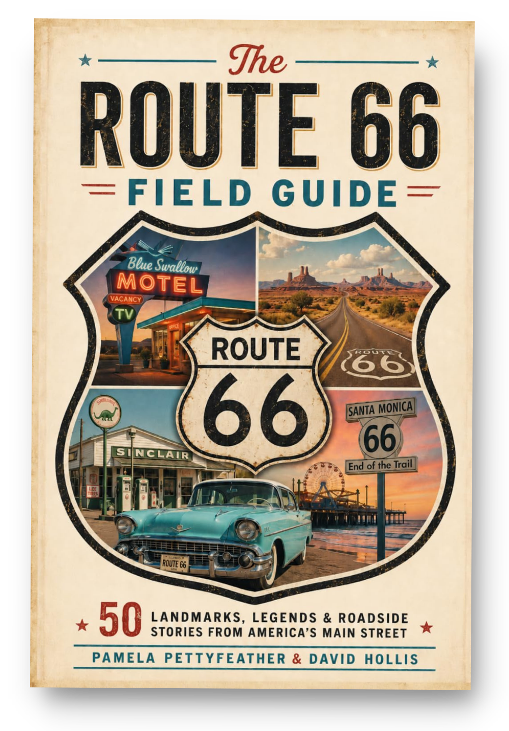
This article draws from The Route 66 Field Guide: 50 Landmarks, Legends & Roadside Stories from America's Main Street, a 50-landmark guide to Route 66 across all eight states.